No Products in the Cart
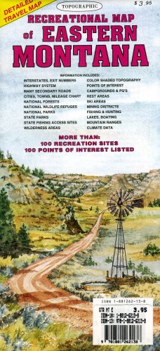
The topographic full color map of Eastern Montana is scaled at 1" = 12.5 miles. Elevation contours every 1,000 feet (color-shaded every 2,000 feet at higher elevations) portray the general geography. Also shown are national forests, wilderness areas, campgrounds, parks, state game and fish areas, ski areas, mining districts, points of interest, and more. More roads are shown than on typical highway maps. Much printed textual information is also included.
 As Seen On TV