No Products in the Cart
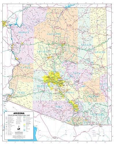
Phoenix Mapping Service Arizona Counties and Roads Small Wall Map, Gloss Laminated is a State of Arizona color wall map detailing counties and roads in a small 24" × 30" size.
This detailed and up-to-date State of Arizona wall map defines counties with pastel coloring. Also included are cities and towns with relevant population information; all of the interstate, state, and tribal highways systems; rivers, streams, and lakes; mountain ranges; tribal lands, military reservations, wilderness areas, and wildlife refuges; and National Parks, Forests, and Monuments.
Gloss Lamination features premium optically clear film which provides a high shine for dramatic color presentation. The gloss laminated map is a convenient and useful at-a-glance reference ready for wet erase or alcohol erase markers, sticker dots or arrows, or graphic tape.
 As Seen On TV