R.I.P. Robert Molner, founder of Wide World of Maps, Inc.
Saddle Mountain, Arizona 7.5'×7.5' 1989 [Map] United States Geological Survey
Wide World Maps & MORE!
$ 12.95
ROCK HOUSE 7.5' AZ 2004 Map United States Geological Survey
United States Department of the Interior
$ 20.95 $ 9.95
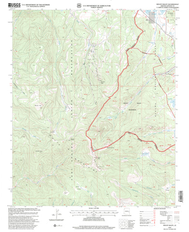
REID VALLEY,ÊAZÊ7.5' PE 1990 [Map] United States Geological Survey
$ 20.95
Phantom Ranch, AZê7.5' 1988 [Map] United States Geological Survey
$ 20.95 $ 12.95
Heber, Arizona (7.5'×7.5' Topographic Quadrangle) [Map] United States Geological Survey
$ 20.95 $ 15.95
HANNAGAN MEADOW, Arizona 1997 (7.5'×7.5' Topographic Quadrangle)
HANKS DRAW, AZ 7.5' 1998 [Map] United States Geological Survey
Eagletail Mountains East,ÊAZÊ7.5' PE 1990 Map United States Geological Survey
Dog Point, AZ 7.5'×7.5' PE 1988 Map United States Geological Survey
Clay Springs,ÊAZÊ7.5' 1998 [Map] United States Geological Survey
Cape Royal 7.5' [Map] United States Geological Survey
Buffalo Ranch, AZÊ7.5' PE 1988 [Map] United States Geological Survey
Alamo Dam, Arizona 1990 (7.5'×7.5' Topographic Quadrangle)
Cochise Stronghold, AZÊ7.5' 1996 [Map] United States Geological Survey
Mount Baldy, Arizona 1997 (7.5'×7.5' Topographic Quadrangle)
Springerville Surface Management Status 1:100,000-Scale Topographic Map (Arizona 60×30-Minute Series)
BOUNDARY BUTTE 7.5' AZ 1998 Map United States Geological Survey
YAMPAI SE, AZ 7.5' 1981 [Map] United States Geological Survey
Bloody Basin 7.5' AZ 2004 [Map] United States Geological Survey
BLACK TANK, AZ [Map] United States Geological Survey

 As Seen On TV


![Heber, Arizona (7.5'×7.5' Topographic Quadrangle) [Map] United States Geological Survey - Wide World Maps & MORE!](http://wide-world-maps-more.myshopify.com/cdn/shop/files/2312_large.jpg?v=1744301597)
![HANNAGAN MEADOW 7.5' 1997 [Map] United States Geological Survey - Wide World Maps & MORE!](http://wide-world-maps-more.myshopify.com/cdn/shop/files/2300_large.jpg?v=1744301604)

![Eagletail Mountains East, AZ 7.5' PE 1990 [Map] [Jan 01, 2017] United States Geological Survey - Wide World Maps & MORE! - Map - Wide World Maps & MORE! - Wide World Maps & MORE!](http://wide-world-maps-more.myshopify.com/cdn/shop/products/41lK0R0mDZL_8d4c3f0e-cc4f-40f7-8a04-2451168aa4bd_large.jpg?v=1744301629)
![Dog Point, AZ 7.5'×7.5' PE 1988 [Map] [Jan 01, 2017] United States Geological Survey - Wide World Maps & MORE! - Map - Wide World Maps & MORE! - Wide World Maps & MORE!](http://wide-world-maps-more.myshopify.com/cdn/shop/products/2238_large.jpg?v=1744301633)


![Buffalo Ranch, AZÊ7.5' PE 1988 [Map] United States Geological Survey - Wide World Maps & MORE!](http://wide-world-maps-more.myshopify.com/cdn/shop/files/2167_large.jpg?v=1744301670)