R.I.P. Robert Molner, founder of Wide World of Maps, Inc.
Dix Creek 7.5' AZ 1989 PE
United States Department of the Interior
$ 20.95 $ 9.95
Davenport Hill, AZ 1989 (7.5'×7.5' Topographic Quadrangle) [Map] United States Geological Survey
$ 20.95 $ 15.95
Daggs Tank 7.5' UST [Map] United States Geological Survey
$ 20.95 $ 12.95
Cunningham Pass 7.5' [Map] United States Geological Survey
Wide World Maps & MORE!
$ 12.95 $ 9.95
CAMP VERDE, AZÊ7.5' 1969 [Map] United States Geological Survey
CAMMERMAN WASH, AZ 7.5' 2004 [Map] United States Geological Survey
ALMA MESA, AZ-NMÊ7.5' 2005 [Map] United States Geological Survey
Cataract Tank 7.5' PE 1989 [Map] United States Geological Survey
$ 9.95
Cane, AZ 7.5'×7.5' PE 1988 [Map] United States Geological Survey
$ 18.95 $ 12.95
Calderwood Butte 7.5' [Map] United States Geological Survey
Burnt Mountain 7.5' [Map] United States Geological Survey
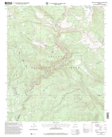
Buffalo Crossing, Arizona 1997 (7.5'×7.5' Topographic Quadrangle)
Blue, Arizona - New Mexico 1997 (7.5'×7.5' Topographic Quadrangle)
$ 20.95
CACTUS FLAT 7.5' [Map] United States Geological Survey
Big Shipp Mountain 7.5' [Map] United States Geological Survey
Big Pug Tank, AZÊ7.5' PE 1990 [Map] United States Geological Survey
Big Horn Peak, AZ 7.5' PE 1990 [Map] United States Geological Survey
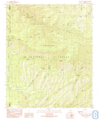
Baldy Bill Point, Arizona PE 1991 (7.5'×7.5' Topographic Quadrangle)
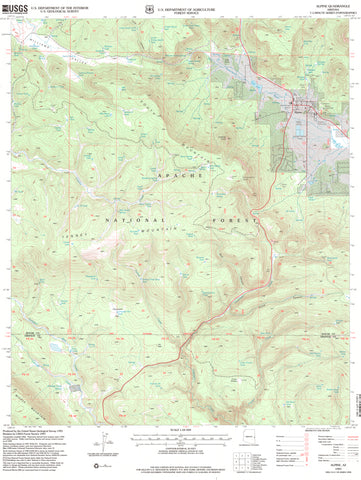
Alpine, Arizona 1997 (7.5'×7.5' Topographic Quadrangle)
SUNSET PASS, AZÊ7.5' PE 1986 [Map] United States Geological Survey

 As Seen On TV


![ALMA MESA, AZ-NM 7.5' 2005 [Map] [Jan 01, 2017] United States Geological Survey - Wide World Maps & MORE! - Map - Wide World Maps & MORE! - Wide World Maps & MORE!](http://wide-world-maps-more.myshopify.com/cdn/shop/products/41lK0R0mDZL_1c33589b-4a23-47ed-a765-1bc8e0fbb8eb_large.jpg?v=1744301659)

![Cane, AZ 7.5'×7.5' PE 1988 [Map] [Jan 01, 2017] United States Geological Survey - Wide World Maps & MORE! - Map - Wide World Maps & MORE! - Wide World Maps & MORE!](http://wide-world-maps-more.myshopify.com/cdn/shop/products/2184_large.jpg?v=1744301665)


![Blue, AZ-NMÊ7.5' 1997 [Map] United States Geological Survey - Wide World Maps & MORE!](http://wide-world-maps-more.myshopify.com/cdn/shop/files/2143-1997ed_large.jpg?v=1744301677)


![Big Pug Tank, AZ 7.5' PE 1990 [Map] [Jan 01, 2017] United States Geological Survey - Wide World Maps & MORE! - Map - Wide World Maps & MORE! - Wide World Maps & MORE!](http://wide-world-maps-more.myshopify.com/cdn/shop/products/41lK0R0mDZL_b252db36-377f-460f-9812-71d0a5dc5e8a_large.jpg?v=1744301681)

![SUNSET PASS, AZ 7.5' PE 1986 [Map] [Jan 01, 2017] United States Geological Survey - Wide World Maps & MORE! - Map - Wide World Maps & MORE! - Wide World Maps & MORE!](http://wide-world-maps-more.myshopify.com/cdn/shop/products/41lK0R0mDZL_b6ff78f1-684f-4874-a3e2-e9c0f9339648_large.jpg?v=1744301703)