Wide World Maps & MORE!
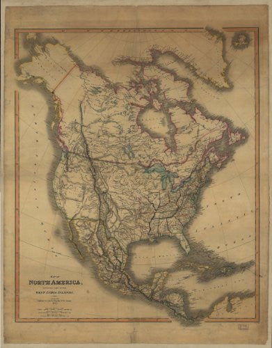
Map of North America Including Part of the West India Islands [Map] C. Smith
$ 65.50
Map of North America including part of the West India Islands Gloss Laminated was original published by C. Smith, mapseller, London, 1849. Colors are used to outline boundaries. (Reproduction.)
114327L


![Arizona Road and Recreation Atlas [Paperback] Benchmark Maps - Wide World Maps & MORE!](http://wide-world-maps-more.myshopify.com/cdn/shop/products/81WodCcaVHL_large.jpg?v=1742587807)
